I was on-site a few years back for a commercial development near the intersection of I-25 and Paseo del Norte. The geotechnical team had already done standard soil borings, but the structural engineer needed to confirm liquefaction potential under the 2015 IBC seismic maps. That's when we brought in a full soil liquefaction analysis. Albuquerque sits in a moderate seismic zone, and with the Rio Grande alluvium underlying much of the city, loose saturated sands can lose strength during shaking. We ran SPT-based evaluations following NCEER procedures, checked fines content, and cross-referenced with ASCE 7 site class criteria. For deeper deposits, we paired the analysis with a MASW-Vs30 survey to capture shear-wave velocity profiles. The client avoided overdesign and saved roughly 18% on foundation costs.
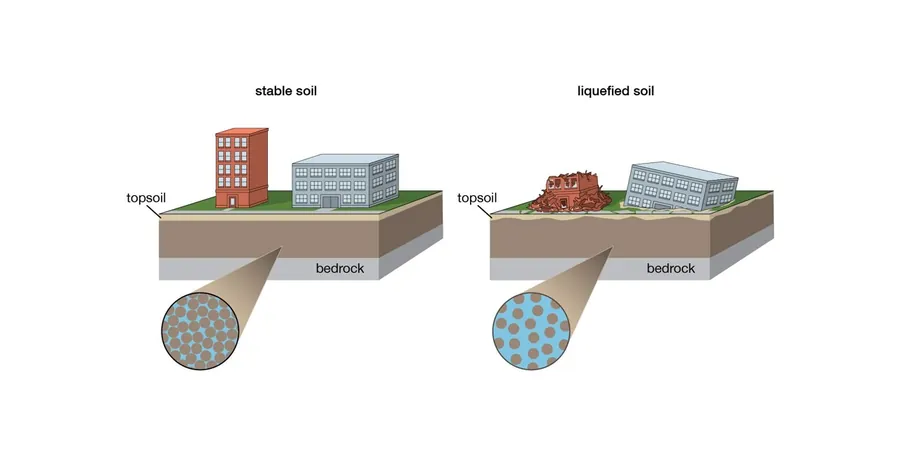
In valley soils, loose saturated sands can lose strength during shaking. CRR vs CSR tells you exactly where the risk lies.
Methodology and scope
Local considerations
The mistake I see most often in Albuquerque is skipping the fines correction. Local contractors sometimes take raw SPT N-values, plug them into a generic chart, and call it a day. That works in clean sand, but our alluvium has variable silt and clay content. A soil with 30% fines and an N-value of 12 might show no liquefaction risk, while the same N-value with 5% fines would be a high-risk layer. We always run washed sieve and hydrometer analysis on the split-spoon samples. The difference can flip a site classification from low risk to high risk, and that changes the foundation system entirely. We've seen projects where a mat foundation was substituted for deep piles simply because the fines correction was applied correctly.
Applicable standards
ASCE 7-16 Section 11.4 – Site class and liquefaction assessment, IBC 2018 Chapter 18 – Geotechnical investigation requirements, NCEER 2001 (Youd and Idriss) – SPT-based liquefaction evaluation
Associated technical services
SPT-Based Liquefaction Analysis
Standard Penetration Test data collection with energy measurement, fines correction, and CRR/CSR computation per NCEER 2001. Deliverable includes depth-specific factor of safety profiles and a liquefaction hazard map for the site.
Vs30 and Site Class Determination
MASW or ReMi surveys to measure shear-wave velocity to 30 m depth. Used to define ASCE 7 site class (A through F) and to compute the site coefficient Fa/Fv for seismic design. Critical for valley sites where soft soils amplify ground motion.
Typical parameters
Frequently asked questions
Does Albuquerque really need liquefaction analysis? The 2014 earthquake near Socorro was only magnitude 5.2.
Yes. Even moderate earthquakes can trigger liquefaction in loose saturated sands. The 1882 Albuquerque earthquake (estimated M6.0) caused sand boils near the Rio Grande. The USGS seismic hazard maps show a 2% probability of exceedance in 50 years for PGA values of 0.15–0.25g in the valley. That's enough to liquefy loose sand with shallow groundwater. We've analyzed over 40 sites in Albuquerque, and about 25% of valley sites had at least one liquefiable layer.
What is the typical cost range for a soil liquefaction analysis in Albuquerque?
For a standard commercial site, the analysis alone (including SPT corrections, fines content testing, and CRR/CSR calculations) runs between US$2,660 and US$4,760. This excludes drilling and field SPT costs, which add roughly US$1,800 to US$3,200 depending on depth and number of borings.
How do you account for the high gravel content in some Albuquerque alluvium?
Gravelly soils can't be evaluated with standard SPT-based methods because the N-values are artificially high. We use a combination of Becker Penetration Test (BPT) and large-scale cyclic simple shear tests on remolded samples. Alternatively, we correlate gravel content to CRR using published relationships by Hatanaka and Uchida (1996). For sites near the Rio Grande where cobbles are common, we recommend at least one BPT hole to supplement the SPT program.