Working east of Tramway Boulevard where the alluvial fans drop from the Sandia Mountains requires a completely different monitoring approach than a project on the old river deposits near Old Town. The transition zone between the basin fill and the mountain front—where Albuquerque sits at roughly 5,300 feet elevation—creates layered profiles of cobbles, sands, and stiff silts that behave unpredictably once you cut more than eight feet down. A single inclinometer isn't enough here. We pair automated total station networks with piezometer strings to catch the early signs of movement and pore pressure change before they cascade into a costly shutdown. For sites within the 100-year floodplain of the Rio Grande, we also coordinate with deep excavation design teams to ensure the shoring system and the monitoring plan are calibrated to the same geotechnical baseline report.
Monitoring on the basin edge is less about measuring total displacement than about detecting the moment when stiff caliche transitions from cap to load.
Process and scope
Area-specific notes
The IBC Chapter 33 excavation safety requirements hit differently in Albuquerque because the city's soil map is essentially two distinct zones: the loose, coarse alluvium that sloughs like sugar and the overconsolidated Santa Fe Group sediments that stand on near-vertical cuts until they don't. When we get a project within half a mile of a mapped fault trace—and there are several running parallel to the Rio Grande—the monitoring frequency doubles. The risk isn't just cave-in; it's differential settlement that can twist a shoring system if the west side of the dig encounters sand while the east side stays locked in caliche. Real-time tiltmeters on soldier piles give us the 15-minute warning that visual inspection alone misses, especially after a monsoon storm saturates the upper bench.
Relevant standards
ASTM D6230 Standard Practice for Monitoring with Inclinometers, IBC Chapter 33 Safeguards During Construction, OSHA 29 CFR 1926 Subpart P Excavation Standards, ASTM D5092 Design and Installation of Groundwater Monitoring Wells, ASCE 7-22 Section 11.8 Geologic Hazards
Linked services
Deep Excavation Instrumentation
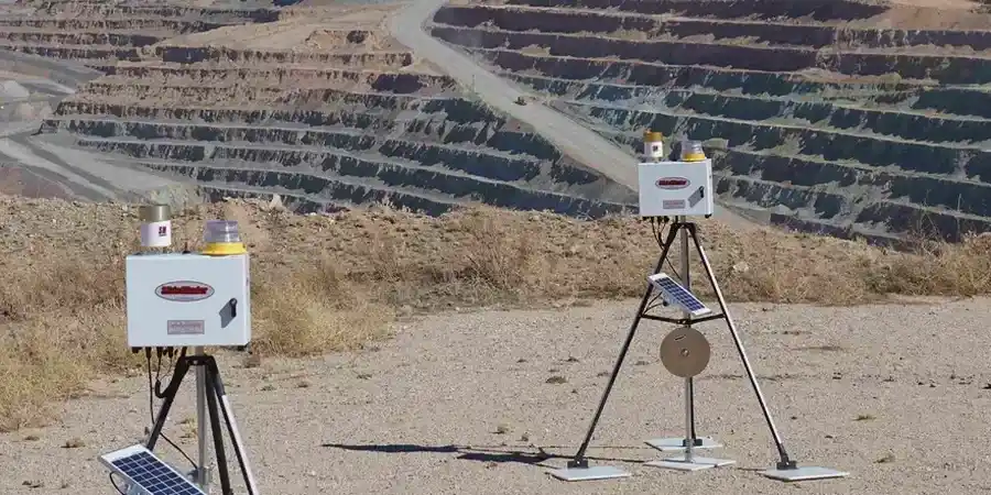
Inclinometer strings, vibrating wire piezometers, and optical survey targets installed per a baseline reading schedule. We manage the data flow and provide weekly plots of cumulative displacement versus excavation depth, correlated to the as-built shoring sequence.
Adjacent Structure Protection Monitoring
Crack meters, tilt plates, and automated total station monitoring on buildings within the zone of influence. Alerts are triggered at 70 percent of the calculated allowable movement, giving the excavation team a buffer to adjust before cosmetic or structural damage occurs.
Typical parameters
Common questions
What is the typical cost for excavation monitoring on a commercial lot in Albuquerque?
Most commercial projects we instrument in the Albuquerque area fall between US$880 and US$2,260, depending on the number of monitoring points, whether automated data loggers are needed, and the total duration of the excavation phase. A small restaurant pad with two inclinometers and a handful of surface points will sit at the lower end; a full-block mixed-use dig with multiple adjacent structures and real-time tiltmeters approaches the upper end.
How deep does an excavation need to be before monitoring becomes necessary in Albuquerque?
While OSHA requires protective systems at five feet, we typically recommend instrumentation once the cut exceeds eight feet in the alluvial fan deposits common across Albuquerque's east side, or ten feet in the stiffer Santa Fe Group soils west of I-25. The trigger is less about depth alone and more about the proximity of structures and the presence of perched groundwater.
What makes Albuquerque soil behavior different from other parts of the Southwest?
The Rio Grande Rift geology creates a sharp contrast over short distances. You can have clean gravels, expansive clays, and partially cemented caliche all within the same excavation face. That layering, combined with our monsoon season from July through September, means that a monitoring plan designed for Phoenix or El Paso won't capture the pore pressure spikes we routinely see here.
How quickly can you mobilize a monitoring team if movement is detected on an existing dig?
For active excavations within the Albuquerque metro area, we can have a crew on site within four hours. The first step is verifying the readings against a manual survey to rule out instrument drift, then we walk the excavation face with the competent person to look for tension cracks or seepage that correlate with the data.
Do you handle the permitting and reporting for City of Albuquerque building officials?
Yes. We prepare the instrumentation plan as part of the geotechnical submittal package, and our weekly reports are formatted to meet the special inspection requirements that the City of Albuquerque Planning Department often attaches to deep excavation permits. We also coordinate directly with third-party special inspection agencies when the project has a separate inspection contract.